Nimba County (Nimba County)
 |
Named after Mount Nimba (Neinbaa Tohn in the Mahn (or Mano) language), which demarcates part of the Guinea-Côte d'Ivoire border, Nimba is also bordered by Bong and Grand Bassa counties to the west, Rivercess County to the southwest, and Grand Gedeh County to the southeast. The northern and northeastern parts of Nimba border the nation of Republic of Guinea, while the northeast lies along the border of Côte d'Ivoire.
Nimba County is one of fifteen counties of Liberia. During the nearly three-decade administration of William V.S. Tubman (1944–1971), the region now called Nimba County was one of three of Liberia's provinces: Western Province, Eastern Province, and Central Province. In the sixties, Tubman reorganized these provinces into counties. Central Province became what is known as Nimba County.
Before the First Liberian Civil War broke out in 1989, the county had a population of over 310,000 people. The top executive in the counties is a County Superintendent, appointed by the president of the county. The current County Superintendent, D. Dorr Cooper, who is the chief administrative officer, was appointed by President Ellen Johnson Sirleaf in 2017. He was re-appointed in 2018 by President George Weah after a change in administrations.
Map - Nimba County (Nimba County)
Map


Country - Liberia
 |
 |
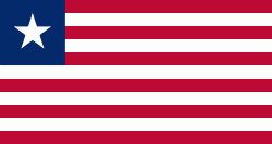
| Flag of Liberia | |
Liberia began in the early 19th century as a project of the American Colonization Society (ACS), which believed black people would face better chances for freedom and prosperity in Africa than in the United States. Between 1822 and the outbreak of the American Civil War in 1861, more than 15,000 freed and free-born African Americans, along with 3,198 Afro-Caribbeans, relocated to Liberia. Gradually developing an Americo-Liberian identity, the settlers carried their culture and tradition with them. Liberia declared independence on July 26, 1847, which the U.S. did not recognize until February 5, 1862.
Currency / Language
| ISO | Currency | Symbol | Significant figures |
|---|---|---|---|
| LRD | Liberian dollar | $ | 2 |
| ISO | Language |
|---|---|
| EN | English language |